
Spring Whitewater Safari
Deua and Shoalhaven Rivers
2-5 October 2022
By KEVIN SONGBERG and BRON POWELL
The Spring Whitewater Safari is normally an annual event on the River Canoe Club calendar, held around the October long weekend with a few days before or after.
Rather than having Grade Two and Grade Three whitewater trips, the safari this year had an emphasis on Grade One and Grade Two whitewater to hopefully allow for more people to participate. It was also focused on being closer to Sydney as the recent rain provided water in rivers without having to find snowmelt flows (bbrrr—chilly).
The planned itinerary also provided a transition from easy to more challenging rivers. It all sounded good—closer to home, warmer, and easier water—which helps those who were a bit rusty at the start!
Deua River
Difficulty: Grade One and easy Grade Two.
After driving through some rain and expecting the ground to be wet and putting a tent up in rain, when Bron and Kevin arrived they were rather impressed that Brian and Paul were already there and had managed to get a ripping fire going despite showers of rain through the day.
We camped at the Bakers Flat campsite in Deua National Park, which was a great location—a perfect start to the safari.
A good aspect of the Deua River is that the road is close to the river, so exits are generally easy, other than the occasional steep banks and bit of prickly scrub.
DAY ONE (2 October)
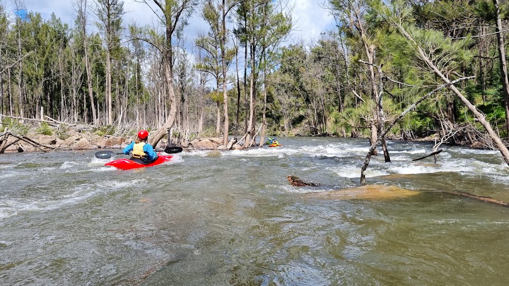
We paddled from approximately one kilometre above Bakers Flat Campground to the Rural Fire Service station, for a total of 13 kilometres. There were short easy rapids, flowing chutes and either moving or flat water between rapids. This was the idea—to start easy to get in the swing of it for those who appreciated a relaxed beginning.
The extra bonus was mostly sunny conditions—we were lucky to get this gap in between rain.
At the end of the paddle, we hid our boats in the bushes so we didn’t have to load and unload again the next day, plus save dragging them all the way up the steep bank. The only concern was a snake that we weren’t sure if it were dead or alive—it was curled up in the typical death adder position!
River levels: During the paddle the gauge at Riverview was mostly steady at about 1.43 metres or 1360 ML/day.
DAY TWO (3 October)
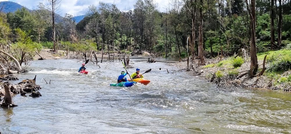
The original plan was a 12 kilometre paddle but we decided to make the most of the river opportunity, good weather and a nice easy paddling water level, so we extended the paddle to 22 kilometres, from the Rural Fire Service station to Lillians Lane.
Little did we know though, we then had 14 portages around log jams—the drought had killed off a lot of trees and then floods washed them into the river. We boofed over a few more fallen trees and went underneath others (with some significant head ducks!). We were joined at lunch by a black snake, which slithered around our picnic spot and ate a frog for lunch.

We ended up finishing a bit later than planned due to the portages, and decided some extra comfort was in order, so we then just camped in an old derelict caravan park in Moruya—it was the only caravan park with vacancies—but it ended up being perfect for our needs with a nice grass lawn, quiet spot and we even had coastal views albeit over 1980s Colorbond fences!
River levels: During the paddle the gauge at Riverview was falling with an average of 1.35 metres or 1230 ML/day.
Shoalhaven River
Difficulty: Grade One and Grade Two with some higher Grade Three portages. Higher-risk drops were portaged.
The river sections were chosen on the combination of scratchy memory of others who had either done it a long time ago or could only vaguely recall bits, and the old Canoeing Guide to New South Wales—all of which pointed to it being as being suitable for Grade Two paddlers, and not being hard sections. Kevin knew of these supposedly easy sections and had long wanted to paddle them. It was also close to get to after the Deua River.
DAY THREE (4 October)
Route: Ferringdon to Bombay Crossing (14 km)
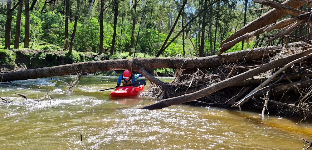
We started out with gentle, easy flowing water but not long after the start, we encountered our first unknown willow choke, which required the first (of a few) portages.
While this section was only moving water with occasional Grade One chutes, these willow chokes are quite dangerous for the unprepared and inexperienced, as they consist of fast flowing water into strainers with limited warning and visibility. We had to be careful on the portages to avoid puncturing our Goretex clothing on blackberries and barbed wire fences.

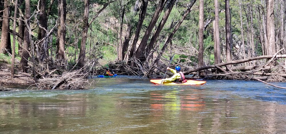
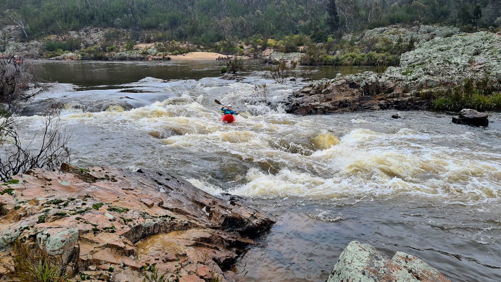
After two willow chokes there were some easy Grade Oneand Grade Two rapids which were pleasant, then approximately two-thirds of the way through this section, the trip suddenly got less suitable for beginners—we then entered part gorge country, with rocky outcrops and lots of Grade Two and some Grade Three rapids.
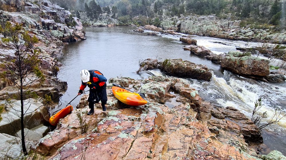
There were also compulsory portages—one being a narrow drop approximately one metre wide that was too risky to paddle, as you couldn’t tell what was underneath the water at the bottom of the drop. The rocky portages were relatively short but steep, climbing down beside waterfalls, and it really helped to have 4-5m of strap carabined to the boats to help drag and lower them. We concluded this section of the river was definitely not for novices as portrayed in the guidebook.
River levels: During the paddle the gauge at Mountview was slowly falling with an average of 1.63 metres or 1100 ML/day.

DAY FOUR (5 October)
Route: Bombay Crossing to Warri Bridge (13km)
Caroline and Fiona joined us on this day. Rain was forecast all day, but we were still keen to paddle this section even though the river was a bit low. It did rain for parts of day but only lightly—we were not concerned about the weather as most of us were wearing dry suits anyway!
Our paddle started by entering straight into expected rocky outcrop countryside, typical of many areas of the Shoalhaven. There were a few easy Grade One chutes, many Grade Two rapids which were fun, two Grade Three rapids, and two compulsory portages over falls which were not safe to run. We were once again glad to have the few meters of soft strap (25mm wide climbing tape) to help move our boats.

The rocky outcrop section took much longer than we thought it would, and we were a bit worried at one point that we wouldn’t make it to the end before dark, but once the rocky section finished, we made good time, until we hit more willow chokes.
There were two of these in the last few kilometres of the paddle. We found the first willow choke was impossible to get through, although the portage was simple on the right bank—or at least, it felt that way after the steep rocky portages.
The last willow choke before Warri Bridge was impossible to tell if there was a clear channel the whole way through. After initially entering with some concerning moments and locations, we decided to embark on another portage out through the scrub via the left bank—the right bank has too many blackberries—and managed to get in a few hundred meters above the end point.
We again concluded that this section of river is not for novices due to the risks and difficulties of willows and rocky outcrop section. Also, the river health really needs a big effort by government contractors or Willow Warriors to get in and clean the willows out!
After getting through the difficult willow choke at the end—which had taken quite some time, with rain that was slowly increasing, and a late-ish finish, we decided that a pub meal in Braidwood was the go for dinner—this was so much better than cooking in the rain.
For the Shoalhaven River sections, we camped at Jinglemoney—which is where River Canoe Club was formed, according to a brief history lesson from Paul, who had attended Basil’s nintieth birthday party nearby. Our campsite at Jinglemoney was a really nice and quiet, with no-one else there—a bush campsite with no facilities which we really liked.
River levels: The river at Mountview was just starting to rise with an average of 1.61 metres or 1000 ML/day. The river at Warri was mostly steady (that is, it had not yet risen) with an average of 1.65 metres or 1100 ML/day.
DAY FIVE (6 October)
Route: Warri Bridge to Larbert (9km)—planned but not paddled
We were frequently checking rainfall in the catchments during the safari to keep an eye on potentially rising rivers. There was a lot of rain on the night of Day Four, and when we checked the river gauges in the morning, we saw that the river was rising significantly.
The scene at Warri Bridge with river flow was the final deciding factor whether to paddle as it was already at 2.7 metres or 7,800 ML/day. It peaked later in the day at 3.6 metres or 18,000 ML/day. Road access to the paddle end over side creeks would have also been difficult.

As we were having breakfast under a picnic shelter due to the rain, a mobile coffee van turned up—having hot coffee or tea that morning was a treat. Significant rain was also forecast for the Canberra area, which then meant that the Murrumbidgee River section that had been planned for the last day or two of the safari would rise too high—it was already high for Grade One and Grade Two paddling at about 3.6 metres or 20,000 ML/day at Mt MacDonald gauge.
We called off the rest of the safari and all headed home witnessing some impressive flooded streams along the way.